Colca Canyon
Peru
Day 1
Distance: 12 km
Ascent: 147 m
Descent: 1,202 m
The Colca Canyon is considered one of the most popular multi-day treks in Peru, so we knew we had to see it for ourselves. There were numerous routes you could take, but we opted for a 3-day, 2-night version that hit the major highlights.
Our starting point was the tiny farming town of Cabanaconde, where we gladly left our main backpacks at a hostel. Just after lunchtime we set out towards Llahuar, a village at the bottom of one of the world's deepest canyons. The route was easy to begin with, running along the top of the canyon and giving us glimpses over the edge. Then the descent began, entirely on a gravel path containing a series of switchbacks. Despite being fairly steep, it wasn't anywhere near as perilous as I was expecting. It wouldn't even crack the top 20 worst descents we had experienced so far in South America, despite feeling like it was never going to end.
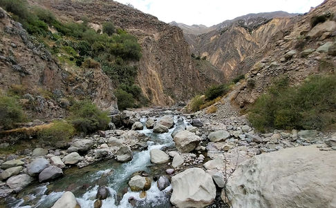
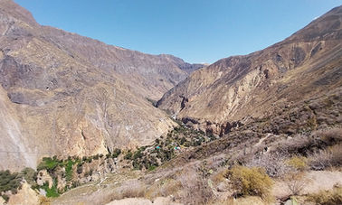
On the way down, the scenery was stunning. The canyon opened up to both the left and right, revealing a raging river at the bottom and small villages dotted along the bank. Every corner seemed to warrant more photos, even though we were looking at the same view 10 minutes ago. Despite the cloudy skies the weather was perfect, with a warm, gentle breeze drifting across the valley. On the entire trek we only saw 3 other hikers, and 2 of them were heading up. I knew this wasn't the most popular section of the Colca Canyon, but I didn't expect it to be this quiet.
Reaching the road near the bottom called for a small celebration, but it was short-lived. Danny found another track that would give us a shortcut between the zigzags in the road and decided it must be part of the official hiking route. I was almost positive that it wasn't. It started out manageable, but it soon turned into bum-sliding and lowering ourselves down vertical rocks and thick branches. Basically, it sucked.
Once we finally reached the road again, we stuck to it. It led us across the river then up and over a small hill, the only real incline of the day. We followed it all the way to our lodge in Llahuar, set at the bottom of the canyon. As soon as we had checked in, we made a beeline for the hot springs. Three pools, at a perfect 39°C, were set right on the turbulent river - it couldn't have been idyllic if it tried. We sat there until the light started to fade, reluctantly climbing out into the cold evening air. Then it was drinks, dinner and off to bed, staying as warm as possible in the surprisingly chilly conditions.


Day 2
Distance: 13.8 km
Ascent: 860 m
Descent: 557 m
The initial stage of day 2 involved hiking straight up a hill for 5 km. We detoured off the road as much as possible, choosing the narrow, tree-lined paths between tiny villages. Every now and then, the view would open up along the canyon before disappearing again behind wild fig trees (with no figs, sadly). In contrast to yesterday, we were treated to clear blue skies and blazing heat. We appreciated the shade when it arrived.
Several dozen hikers all left the hostel at a similar time, so we were rarely alone on our trek. The one exception was heading up to Mirador Apacheta, where everyone else decided the road was the best option. We thought the sketchy-looking path with the crumbling edges was the way to go. It got us there in the end, with superb views of the canyon in both directions.
Instead of taking the road all the way to our destination, San Juan de Chuccho, we detoured down towards the main hiker town of Sangalle, but without going all the way to the bottom of the canyon. Sangalle looked like a lavish resort from above, with several swimming pools in lush green surroundings. The music was already blaring early in the morning, which made us glad we wouldn't be staying at the party hostel.
A steep but stable path led us down to a cactus-filled plateau, where we found a rustic shack selling overpriced snacks and drinks. From here, we could have cut directly across to San Juan de Chuccho, but we wanted to take the slightly longer route further up the mountain, mainly because our map said there were viewpoints along the way. We also wanted to see if there were any lunch options in the village along the main road. At least the viewpoints were worth it, because the only food we found was a tiny shop with a few snacks for sale. The chatty saleswoman asked us all sorts of questions in Spanish that I half understood, or at least pretended to. Most of my answers were yes, no, places and numbers. In the end, we bought some fruit and continued on.
The final section required us to take a thousand or so tight, short switchbacks down the mountain on a gradient that appeared worse than what it actually was. With all of these descents, it was miraculous that I hadn't fallen over yet. At the bottom, it was a straightforward walk past numerous avocado trees to the hostel in San Juan de Chuccho, which, in the early afternoon, was completely mobbed by tour groups. Thankfully, 90% of them were passing through on their way to Sangalle. An hour later we were left in peace and quiet in the serene garden setting.


Day 3
Distance: 9.7 km
Ascent: 1,029 m
Descent: 169 m
In order to make our connecting bus to Puno (Lake Titicaca), we needed to be back in a Cabanaconde by 9 a.m. From San Juan de Chuccho, the hike was almost 10 km long with over 1000 metres of ascent directly up the canyon wall. It was pitch black when we set out at 5.30 a.m., using our headlamps to follow a narrow path to the river. Once we crossed over, it was all up, up, up on a gravel and rock trail. The gradient averaged 20% but it felt manageable the whole way (it helped that the sun didn't hit us until we were halfway up - in the middle of the day the climb would have been insufferable).
Sunlight slowly revealed the canyon to us, although it wasn't as awe-inspiring as the first 2 days. We mainly stared at our feet, willing ourselves to go faster in order to make the bus on time. Just before reaching the rim, we realised we were well ahead of schedule, so we reduced the pace and enjoyed our last few minutes inside Colca Canyon.
From the top, it was an easy walk along a paved road all the way to Cabanaconde. We arrived early enough to order a simple takeaway breakfast, which we ate in the centre square while soaking up the warmth of the sun (it was surprising how quickly we cooled down when we stopped moving). In the end, we spent less than 48 hours inside the canyon, but it had been a rewarding and memorable part of Peru that we were glad to have experienced.


